
CAD/AVL (Computer-Aided Dispatch/Automatic Vehicle Location) systems are crucial for modern transportation, as they enable real-time fleet monitoring, resulting in enhanced operational efficiency, improved safety, and a more elevated passenger experience. These solutions function as the central nervous system in a transit agency’s operations, connecting vehicle GPS data (AVL) with dispatcher control (CAD) to manage disruptions, optimize routes, and provide passengers with timely information. This significantly reduces stress and increases customer satisfaction. By providing data for immediate dispatch adjustments, transport authorities can deliver accurate arrival predictions and better resource allocation, making public transport more reliable and responsive.
In this article, we’ll examine how CAD/AVL systems transform public transit by helping authorities shift from reactive to proactive management, ensuring reliable, safe, and efficient service in complex urban environments. We’ll also discuss some of the solutions available on the market and how agencies can integrate them into their ecosystems for the most optimal results.
Understanding The Role Of Automatic Vehicle Location And Computer-Aided Dispatch Systems In Transit
Automatic Vehicle Location (AVL) systems utilize GPS on public transit vehicles to send real-time location data to a central Computer-Aided Dispatch (CAD) system, enabling dispatchers to monitor, manage, and communicate with fleets. Each transit vehicle is equipped with a system of sensors, primarily GPS units that constantly determine its precise location, speed, and direction. This data is then transmitted wirelessly, connecting to devices such as electronic headsigns (route displays), automated voice announcers, and driver communication devices. Unlike standard GPS, CAD/AVL connects live location data (AVL) directly to dispatchers’ screens (CAD), allowing them to see exact vehicle positions, speeds, and statuses instantly.

Dispatchers can then make immediate, data-driven decisions to adjust routes, manage headways, or dispatch replacement vehicles if needed, without causing disruptions to services. By enabling proactive service management, these systems significantly improve schedule adherence, reducing delays and the frustration associated with uncertain wait times. CAD/AVL systems are also the core technology behind Real-time Passenger Information (RTPI) Systems, helping to deliver accurate vehicle locations and arrival predictions via apps, websites, digital signs, and onboard announcements, further boosting rider satisfaction and confidence. CAD/AVL systems are designed to facilitate swift communication between drivers and dispatchers, which also helps enable rapid coordination with emergency services.
How Data From CAD/AVL Systems Helps Agencies Save Money And Enhance Operational Efficiency
CAD/AVL systems automatically collect vast amounts of data on fleet activity, including trip durations, speed, and frequency of stops. This data can be used to generate detailed reports and analytics for monitoring key performance indicators and making informed decisions about future service needs and resource allocation. Route optimization and monitoring promote eco-driving practices such as minimizing idling, unnecessary acceleration, and abrupt stops, which lead to significant savings in fuel or electricity use. Integration with asset management systems further enables condition-based, preventive maintenance scheduling based on real-time vehicle diagnostics and usage data, rather than fixed schedules. This reduces unexpected breakdowns, minimizes vehicle downtime, and extends the lifespan of fleets.
Many modern CAD/AVL systems are also cloud-based, which shifts costs from large capital expenditures (on-site servers, dedicated IT staff) to more predictable monthly fees. This approach also offers scalability and simplifies future system upgrades or integrations with other technologies, such as contactless fare collection. A unified CAD/AVL system further enables transit agencies to transition from paper-based, manual processes to a connected, real-time ecosystem, providing significant long-term benefits for both operators and the public. Automating functions such as vehicle tracking and performance reporting reduces the dependence on manual processes and field supervisory personnel, freeing up staff to focus on other tasks. A quick response to incidents and effective data collection for accident reports can also help mitigate the costs associated with accidents and service disruptions.
Implementing CAD/AVL Into Modern Transit Operations
Integrating CAD/AVL into modern transit often means connecting GPS/dispatch with fare collection, passenger counters (APCs), digital signs, maintenance (asset management), and customer apps for real-time tracking. This leads to various beneficial outcomes, including optimized routing, enhanced maintenance, improved safety, and rider information such as ETAs and overcrowding alerts. Through this, public transportation authorities can create a data-driven ecosystem for proactive management, efficiency, and superior passenger experience. Modular and cloud-based solutions further enable gradual upgrades and remote management, reducing costs and complexity for agencies. This allows agencies to implement new technology in stages rather than executing a high-risk, all-at-once overhaul.
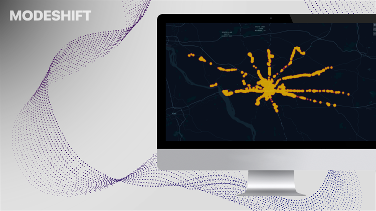
Modeshift integrates its CAD/AVL system into its broader fare collection platform by using real-time vehicle data (GPS, location) from AVL to enhance fare management, optimize operations, and provide riders with accurate information. This is all part of a unified, cloud-based system that connects dispatch, scheduling, and passenger services. This comprehensive SaaS offering digitizes all public transport processes, from ticketing to reporting, for a seamless, data-driven transit experience. In 2021, Modeshift’s system helped Freedom Transit modernize its operations and gain crucial insights into its system, moving away from a predominantly cash-based, less trackable system.
How it Works:
- Data Integration: The CAD/AVL system tracks vehicle GPS and status, feeding live data directly into the central Modeshift platform, built on Microsoft Azure.
- Unified Platform: This platform combines account-based ticketing, mobile apps, CAD/AVL, and real-time passenger information (RTPI) into a single system.
- Operational Efficiency: Dispatchers utilize the integrated data for real-time monitoring, enhancing schedule adherence while managing emergencies and improving service.
- Enhanced Rider Experience: Riders benefit from accurate arrival times via mobile apps linked to AVL data and can use their accounts across multiple services.
- Comprehensive Digitalization: This allows agencies to manage everything from fare validation (smartcards/mobile) to reporting (emissions, ridership) from a single source, digitizing the entire transit ecosystem.
By integrating CAD/AVL into its ecosystem, Modeshift is capable of offering a holistic solution for modernizing public transit, moving beyond just payments to full operational intelligence and rider engagement.
How CAD/AVL Systems Integrate With Modern Payment Systems
Computer-Aided Dispatch (CAD) and Automatic Vehicle Location (AVL) systems integrate with modern payment systems primarily through the use of Application Programming Interfaces (APIs) to share real-time operational data, enabling a seamless and location-aware fare collection experience for passengers and agencies. This integration facilitates the exchange of data flow between the operational (CAD/AVL) and financial (payment) systems, typically by using a centralized platform or cloud-based infrastructure. The core of the integration involves the CAD/AVL system sending real-time data to the fare collection system, which includes the vehicle’s precise GPS location, the current route, stop information, and status regarding schedule adherence.
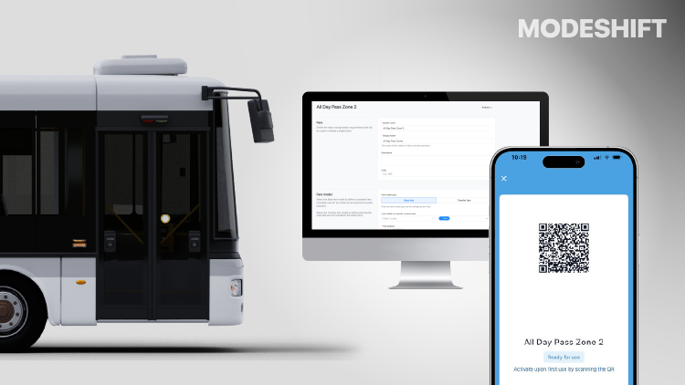
The CAD/AVL system’s onboard computer or Mobile Data Terminal (MDT) is physically connected to the fare collection device (farebox, smart card reader, or mobile app validator). The payment system then uses the CAD/AVL’s location data to apply the correct fare logic. This is crucial for systems with zonal or distance-based pricing, ensuring the right amount is charged based on where a passenger boards or disembarks. When a passenger taps a smartcard or validates a mobile ticket, the fare collection device instantly communicates with the integrated system to verify the ticket’s validity for that specific route and time. All transaction data is then sent to a central back-office system where it is logged, reconciled, and used for reporting and analysis.
In Conclusion
Transit agencies should approach investing in a Computer-Aided Dispatch/Automatic Vehicle Location (CAD/AVL) solution as a strategic modernization effort rather than just purchasing hardware. Key considerations include vendor reliability, system scalability, integration capabilities with existing infrastructure, and the choice between cloud-based or on-premises hosting. This involves identifying core needs, such as determining whether the focus is on improving on-time performance, enhancing safety through emergency response tools, optimizing routes, or providing real-time passenger information. Agencies should also consider a phased approach to modernization rather than a complete overhaul, which reduces risk and budget disruption.
It’s also vital to ensure the solution can grow with the agency, allowing for the addition of new vehicles, routes, or modules, such as Automatic Passenger Counters (APCs). The CAD/AVL system must also be compatible with existing systems, such as fare collection, APCs, and digital signage. A system that supports API integration is crucial to avoid data silos. Cloud-hosted systems further offer higher accessibility, rapid deployment, and easier maintenance, whereas on-premises systems may be required for specific security needs. By investing in a CAD/AVL solution, transit agencies can enable real-time fleet control, significantly enhancing the passenger experience while boosting operational efficiency and facilitating data-driven decisions for service enhancements.


