
Real-time intelligence in public transit, powered by AI, Internet of Things (IoT), and Automatic Vehicle Location (AVL) systems, acts as a cornerstone for enhancing passenger satisfaction by reducing uncertainty, minimizing wait times, and improving service reliability. By providing accurate, up-to-the-minute data via mobile apps and digital signage, transit operators can significantly improve the passenger experience, with studies showing a 20–30% reduction in perceived waiting times.
In this article, we’ll examine some key strategies for leveraging real-time intelligence to improve the passenger experience. We’ll also consider the impact of emerging technologies on public transit and how they’re enabling agencies to transition from reactive, schedule-based operations to proactive, data-driven services.
The Importance Of Real-Time Information And Predictive Technology
Leveraging real-time intelligence to boost passenger satisfaction involves transforming raw data into actionable insights that enhance reliability, comfort, and communication. Computer-Aided Dispatch/Automatic Vehicle Location (CAD/AVL) acts as the backbone of modern Real-time Passenger Information (RTPI) systems by integrating real-time vehicle tracking with backend scheduling and dispatching software. By combining GPS-based vehicle tracking with automated dispatching tools, these systems enhance service reliability, improve safety, and deliver real-time information to passengers. AVL technology uses GPS sensors installed on transit vehicles to track their precise location, speed, and direction in real-time, feeding data to a central system. CAD software receives this real-time data, allowing dispatchers to monitor schedules, manage routes, and communicate with drivers.
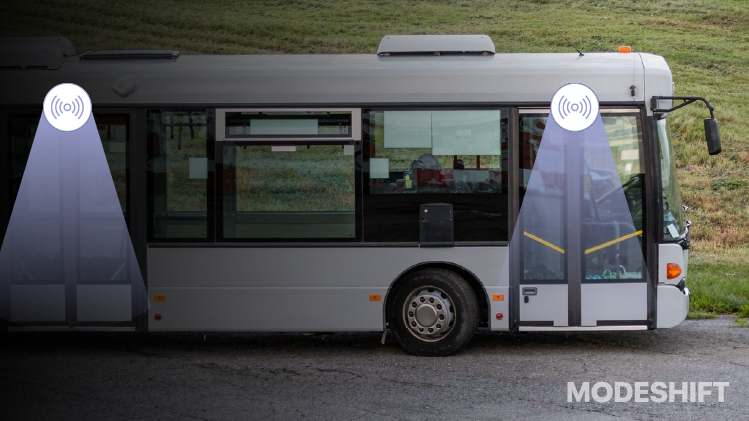
This intelligence is crucial in making dynamic service adjustments to routes, schedules, and vehicle assignments based on immediate conditions such as traffic congestion, accidents, or surges in passenger demand. When an event such as a breakdown, accident, or heavy traffic occurs, CAD/AVL provides the necessary visibility that enables dispatchers to react accordingly, such as sending replacement vehicles, initiating detours, and redirecting resources where they are most needed. Once service adjustments are made, the system automatically updates real-time arrival predictions (ETAs) on mobile apps, websites, and digital signs at transit facilities, ensuring passengers are aware of changes. By facilitating adherence to schedules, CAD/AVL dramatically enhances service reliability, which directly translates to increased rider trust, loyalty, and higher ridership, boosting farebox revenue.
Tools For Increased Passenger Comfort And Personalization In Transit
Transit agencies are increasingly utilizing their own, branded mobile apps powered by real-time intelligence to transform commuting from a rigid, stressful experience into a flexible, user-centric service. By integrating AI-powered analytics with Automatic Vehicle Location (AVL) and Automatic Passenger Counter (APC) data, these apps offer customized routing, real-time crowding insights, and seamless digital ticketing. Instead of relying on static schedules, apps provide live, predictive, and frequently updated vehicle locations, allowing riders to know exactly when their bus or train will arrive, reducing anxiety. AI analyzes passenger counting sensors to inform riders of the current capacity levels, enabling them to choose a less crowded and more comfortable ride. Instant notifications regarding detours, accidents, or delays help passengers plan alternatives before they are stuck.
Apps are now moving beyond single-mode tracking to integrate public transit with bike-sharing, scooters, and ride-hailing for comprehensive door-to-door, multi-modal trip planning. Integrated Mobility-as-a-Service (MaaS) apps use Artificial Intelligence (AI), IoT data, and predictive analytics to create seamless, user-centric transportation networks. By aggregating public transit, ride-sharing, bike-sharing, and other services into a single interface, these platforms provide real-time updates, optimized routing, and unified ticketing. AI analyzes data from traffic, weather, and transit schedules to reduce urban congestion. Digital, contactless, and mobile payments (e.g., Apple Pay, Google Pay) further eliminate the use of physical tickets in public transit. Apps now automatically calculate the lowest fare, offering “fare capping” where users stop paying once they reach a daily or weekly limit. Many apps also provide audio, visual, and navigation tools designed specifically for riders with disabilities, such as guiding them to a stop or announcing arrivals.
Applying Real-time Intelligence To Maximize Operational Efficiency
Real-time intelligence transforms public transit operations by replacing static, schedule-based systems with dynamic, data-driven networks that adapt instantly to changing conditions. By leveraging AI, IoT sensors, and live data (such as GPS, APC, and passenger counts), transit agencies can move from reactive, crisis-driven management to proactive, predictive operations. IoT sensors on vehicles monitor components such as engines, brakes, and battery health in real-time, enabling repairs before breakdowns occur. This has been shown to reduce unplanned downtime by up to 45%. AI can be particularly useful in detecting potential failures in ticketing machines, gates, or vehicle components (e.g., unusual vibrations in a ticket gate motor), which limits repair costs and service downtime.
Real-time intelligence serves as the foundational data layer for dynamic fleet optimization in public transit, transforming fixed-route systems into fluid, demand-responsive networks. Instead of relying on static, pre-set schedules, AI-powered systems reassign vehicles based on actual traffic conditions and passenger demand. AI analyzes real-time traffic and ridership data to suggest route changes, adjust bus/train frequency during unexpected surges (e.g., events, accidents), and reduce “bus bunching” to maintain consistent headways. The technology interacts with city traffic management systems to adjust traffic light timings, allowing buses and trams to pass through intersections with minimal stopping, thus reducing delays. This limits fuel consumption and unnecessary mileage, improving overall fleet utilization. By aligning capacity with real-time demand, passengers experience shorter wait times and less crowded vehicles, which enhances trust and increases ridership.
Leveraging Real-time Intelligence For Improved Revenue And Fare Management
Real-time intelligence enables transport agencies to optimize revenue and manage fares by providing up-to-the-minute data on passenger demand, allowing for dynamic and responsive adjustments to pricing, capacity, and fraud prevention. By utilizing IoT sensors, camera-based AI, and automatic vehicle location (AVL) systems, agencies can shift from reactive, static models to proactive strategies that maximize revenue while enhancing the user experience. Real-time Passenger Information (RTPI) systems provide crucial, up-to-the-minute data, including live arrival/departure times, as well as service delays, which help passengers make informed decisions about their journeys. This creates a “frictionless” travel experience that boosts ridership, optimizes service based on demand, and reduces revenue leakage.

Agencies can also combine location data from vehicles with payment validation to further implement dynamic pricing and Account-based Ticketing systems. This means the passenger’s fare is calculated in the back office rather than at the point of entry. As passengers tap credit cards or mobile devices, the system immediately validates each transaction, enabling seamless, contactless, and secure payments. Agencies can then implement real-time fare capping, ensuring riders pay the best price automatically, which increases loyalty and encourages higher transit usage. Some transportation companies are utilizing open data standards such as GTFS-RT (General Transit Feed Specification – Realtime) to connect CAD/AVL (Computer-Aided Dispatch/Automatic Vehicle Location) data with modern, API-driven fare collection systems. This allows them to avoid expensive, proprietary, single-vendor, and “bundled” solutions.
Benefits Of Using Cloud-Native “360-Degree” Platforms In Public Transit
To improve customer satisfaction, agencies can invest in a cloud-native “360-degree” platform that connects fare collection, vehicle location (CAD/AVL), and passenger information. Integrated, cloud-based software suites that centralize transit data and operations provide transformative benefits to public transit agencies by replacing rigid, on-premise, and siloed systems. These platforms, which utilize real-time data, provide a comprehensive view of operations, encompassing vehicle tracking, rider demand, and maintenance needs. This allows agencies to avoid the high capital expenditures and maintenance costs associated with on-premise hardware. Integrated, two-way driver-dispatcher communication tools in CAD/AVL technology further enable real-time operational coordination through а unified, cloud-based platform, connecting vehicle hardware with back-office software.
Dispatchers can send instant updates directly through the platform regarding route changes, traffic alerts, or scheduling adjustments. This means that driver-reported incidents or changes can be immediately reflected in the central system, ensuring that both planners and drivers have the same, up-to-date information. The two-way communication tools give control centers a clear, real-time view of what is happening on the road, enabling quicker responses to service disruptions. When Computer-Aided Dispatch/Automatic Vehicle Location (CAD/AVL) is combined with Account-based Ticketing, agencies can also view the real-time location of vehicles and identify who is on them. This enables fare collection devices to pinpoint the route and stop of each transit vehicle during a validation event, which is essential for accurate, distance-based, or zonal fare calculation. Passengers benefit from faster, cashless, and seamless boarding, as well as precise, real-time vehicle tracking via mobile apps.
In Conclusion
The successful implementation of real-time intelligence in public transit requires overcoming significant hurdles, primarily centered around high initial costs, data privacy concerns, staff training, and cybersecurity vulnerabilities. Addressing these issues is essential for transitioning beyond pilot projects to robust, wide-scale, and secure, data-driven transit systems. Public transport agencies with limited budgets can upgrade to real-time CAD/AVL systems by adopting cloud-based software, using modular/phased implementation, and leveraging existing, off-the-shelf hardware to minimize upfront capital expenditures. These technologies, such as GPS-based trackers and cloud platforms, enable remote, scalable, and affordable fleet monitoring, which helps avoid costly, in-house infrastructure. Agencies are also investing in training programs to help existing staff adapt to new technologies, rather than solely relying on external hiring, which can be expensive and competitive.
Public transportation agencies can mitigate cybersecurity risks related to real-time data and third-party vendors by implementing a multi-layered, zero-trust approach that combines technical controls such as encryption and network segmentation with contractual, operational, and vendor risk management strategies. As transit systems become more connected and reliant on external vendors for scheduling, ticketing, and passenger information, agencies must treat cyber risks as critical operational threats rather than just IT issues. Reliable real-time intelligence in public transit is also heavily reliant on high-quality, standardized data to function effectively. Standardized formats such as GTFS-RT can help agencies share and interpret real-time data on vehicle locations, service adjustments, and disruptions. The adoption of dynamic, real-time intelligence is a crucial step towards future-ready, sustainable, and passenger-centric urban mobility, enabling agencies to make data-driven decisions that balance efficiency with service quality.


