
Integrating micromobility services into urban planning requires a comprehensive approach that encompasses physical infrastructure such as mobility hubs, dedicated bike lanes, and smart parking. To achieve this, cities are adapting streets and sidewalks to support micromobility devices, along with implementing strong policies and establishing clearly defined geofenced “no-go” zones. Creating designated parking spots and enacting dynamic regulations that respond to real-time data and user needs are also essential for ensuring these new modes can coexist with current transportation options. This is further supported by digital solutions, such as mobile apps, real-time information systems, and unified payment platforms. Fare integration, which involves fare policies such as subsidies and combined passes, is especially crucial in providing seamless user experiences that promote sustainable, car-free transportation.
In this article, we’ll explore some of the key ways cities can incorporate micromobility into urban planning through various strategies and initiatives. We will also offer insights into how public transport authorities can foster collaboration with micromobility operators to ensure efficient and equitable service provision.
The article in a nutshell:
- Implementing supportive and adaptive regulations for shared mobility solutions
- Why data-sharing platforms are key to advancing micromobility
- Investing in infrastructure integration and development
- Integrating mobility hubs in smart city planning
- Using artificial intelligence for micromobility service planning and delivery
- Solving some of the biggest issues surrounding micromobility
- In conclusion
Implementing Supportive and Adaptive Regulations For Shared Mobility Solutions
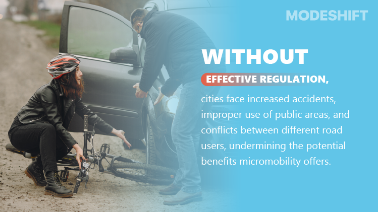
Regulating micromobility services is crucial for urban planning as it mitigates the risks of accidents and injuries for both micromobility users and pedestrians by establishing clear rules for vehicle operation and use of public roads. Reinforcing regulations helps manage the placement and parking of micromobility devices, preventing clutter on sidewalks and ensuring accessibility for pedestrians, especially those with reduced mobility. Without effective regulation, cities face increased accidents, improper use of public areas, and conflicts between different road users, undermining the potential benefits micromobility offers. By establishing smart, data-driven strategies and clear rules, cities can integrate micromobility services in a way that is organized and sustainable, preventing chaos while fostering an efficient transportation ecosystem.
European countries, such as Spain and Scandinavia, have established robust frameworks for regulating shared mobility, including limiting the number of operators, requiring insurance, and specifying vehicle maintenance standards. In Norway, the city of Bergen has successfully reinforced vehicle caps in certain areas to control congestion, which has improved services and reduced parking issues. To manage space efficiently, cities such as Stockholm, Berlin, and Leuven are implementing designated parking zones and mobility hubs. Sweden’s capital, Stockholm, in particular, uses data to reinforce penalties for poorly parked e-scooters, encouraging operators to maintain order in public spaces. The Mobility Data Specification (MDS) has been an indispensable tool for cities in managing and regulating shared mobility modes, as it standardizes data sharing between public agencies and private operators.
Why Data-sharing Platforms Are Key To Advancing Micromobility
Shared mobility data enables dynamic, data-driven regulations by providing real-time insights into user behavior and service performance. This allows cities to move beyond rigid, static rules toward flexible, adaptive policies that respond to actual demand and usage patterns. By leveraging data for performance-based incentives and penalties, micromobility providers can adjust fleet sizes or service availability based on real demand instead of fixed limits. When fleet sizes are flexible, cities can automatically modify the number of vehicles dispatched according to current needs. For example, more scooters could be deployed during peak hours and fewer during off-peak times. This approach results in more responsive and efficient services that are accessible to all users with minimal disruption.
Authorities can also incentivize providers based on key performance indicators, such as reducing congestion or emissions, rather than relying on fixed, potentially counterproductive measures. The German city of Hamburg has launched a pilot program that uses data from its four active e-scooter providers. The program provides a detailed data dashboard showing the location, count, and length of daily scooter rides throughout the city. This has allowed authorities to manage fleet sizes and distribution, helping identify service gaps and improve scooter parking management. The data has also been instrumental in facilitating more informed decisions regarding which providers to license. Cities with multiple mobility providers often license all of them, hoping the best will stand out among their competitors, rather than selecting the ones most suited to their community’s needs.
Investing In Infrastructure Integration And Development

Enhancing urban infrastructure is a critical aspect of promoting safety in micromobility. Cities are building dedicated e-scooter lanes, improving signage and road markings, and implementing traffic calming measures to reduce accidents. Some cities are even experimenting with smart technologies, such as speed limiters and geofencing, to control e-scooter speeds and restrict access to certain areas. Adapting infrastructure to accommodate micromobility modes through the use of dedicated lanes and multi-use paths can help reduce conflicts with pedestrians and other vehicles. This is further supported by the introduction of mobility hubs that integrate micromobility with public transport, offering charging stations, safe storage, and real-time route information. Converting car parking spaces into designated micromobility parking zones will also help reduce clutter, while encouraging the use of greener forms of transport such as e-scooters and e-bikes.
A single, standard-sized car parking bay can accommodate up to 20 e-scooters, so converting car parking spaces into e-scooter parking zones can simultaneously boost micromobility usage and discourage car driving. Countries such as Sweden and Germany are conducting trials with automatic speed restrictions for micromobility, which rely on technology such as geofencing combined with intelligent speed adaptation (ISA) to enforce speed limits for e-scooters. Such speed restrictions can help scooters safely share pavements and cycle paths with other users. Geofenced “no-go” areas can address pedestrian concerns over inappropriate scooter use. Other European cities, such as Amsterdam and Copenhagen, are recognized as leaders in integrating micromobility into existing networks by establishing extensive bike lane networks that cater to both bicycles and e-bikes.
Integrating Mobility Hubs In Smart City Planning
Mobility hubs facilitate multimodal trips by providing integrated, accessible locations for shared transportation options like bikes, scooters, and public transit, enabling smooth connections for the “first and last mile” of a journey. The first step in establishing mobility hubs is pinpointing locations that serve as key nodes for different transportation modes and areas with high demand, such as popular station zones, downtown districts, and residential neighborhoods. Cities should develop master plans for station areas that account for the various modes and their integration with existing urban and rural environments. Working with private companies and government agencies to plan, finance, develop, and operate hubs efficiently is equally crucial. When designing hubs, city planners need to include infrastructure that supports all modes, such as charging stations for shared bikes and e-scooters, car-sharing facilities, and EV charging points. Adding user amenities such as shelters, water fountains, playgrounds, and secure bike storage is essential to enhance the user experience.
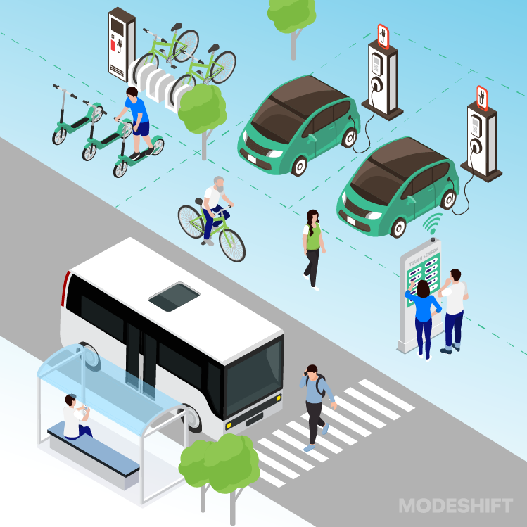
Hubs must connect seamlessly with walking and cycling networks, including well-maintained sidewalks and bike lanes. Mobility as a Service (MaaS) platforms are essential for integrating booking, payment, and real-time information across various mobility services. Cities can also develop specific APIs (Application Programming Interfaces) to enable transport providers and apps to integrate with the hub’s services. Oslo is the first European city to have successfully integrated its bike share system into its public transport authority’s official ticketing app. The Ruter app acts as a central platform where users can find, book, and pay for different transportation options, including public transit and micromobility services. This simplifies access to shared bikes and scooters, making it easier for people to manage their first and last mile commutes while improving overall accessibility to public transportation.
Using Artificial Intelligence For Micromobility Service Planning And Delivery
Artificial Intelligence can be leveraged to optimize fleet operations in micromobility through predictive fleet maintenance and demand forecasting, leading to improved user experiences with personalized routing and real-time updates. AI algorithms analyze real-time and historical data to predict maintenance needs, forecast demand, and optimize the rebalancing of vehicles across a city, ensuring availability where and when it’s needed most. AI is also capable of adjusting rental costs based on demand, time of day, and location to maximize revenue and customer retention. Cities can use AI to automate task assignments for ground teams, streamlining daily operations such as battery swapping and maintenance, which could significantly reduce costs. AI algorithms are especially effective in monitoring vehicle performance and can predict mechanical failures before they occur, ensuring vehicles are always in a safe operating condition.
By analyzing real-time sensor data from video cameras, input from LiDAR, radar, and GPS, AI systems can detect multiple hazards, obstacles, other road users, and dangerous road conditions. They use computer vision for object and anomaly detection, predictive analytics to forecast accident risks, and sensor fusion to form a comprehensive view of the environment. When a hazard is detected, the AI system immediately sends notifications to the micromobility operator, authorities, or the rider to warn them of the danger. In emergencies, AI can automatically apply brakes on micromobility vehicles to prevent a collision. Helsinki is currently testing an AI pilot program, where 40 Tier-Dott e-scooters are equipped with AI-powered sensors that collect real-time data on rider behavior, such as hard braking or swerving, as well as road conditions. The data is then analyzed by an advanced platform to identify high-risk areas and situations, helping facilitate proactive infrastructure improvements and safety measures.
Solving Some Of The Biggest Issues Surrounding Micromobility
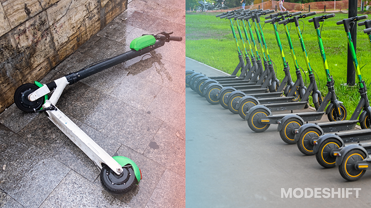
Some of the biggest issues with micromobility in cities involve finding proper parking and placement for vehicles. Dockless vehicles can be left anywhere, blocking sidewalks and creating hazards for pedestrians, especially for those with mobility challenges. Poorly parked shared e-scooters and bikes have caused significant public frustration and negative perceptions. Some cities have even gone so far as to ban micromobility vehicles such as e-scooters entirely. To address this, cities can create clearly marked physical parking corrals and integrate them with existing bicycle racks to provide designated, secure spots for shared vehicles. Equipping vehicles with physical locks that secure them to bicycle racks or street infrastructure can also prevent improper parking and theft.
Bluetooth Beacons embedded in pavements can further deploy wireless signals to verify whether a vehicle is parked within a designated area, offering a highly accurate and reliable alternative to GPS, especially in areas with weak satellite reception. Technologies like ParkedByMe utilize solar-powered antennas to ensure precise placement and can generate data-driven insights for city planning. Micromobility operators can include geofenced zones in their apps to direct users to designated parking areas or restrict parking zones, often alongside visual aids such as app maps and real-time navigation. Offering financial incentives for correct parking in designated zones and imposing penalties for violations can further encourage user compliance.
In Conclusion
Micromobility services can enhance urban transport systems by connecting residents to vital societal locations such as employment, education, and healthcare, particularly in underserved communities. By offering users convenient, on-demand transportation that is flexible and affordable, cities can effectively bridge gaps for short trips and expand access to traditional transit options. To increase availability to a wider range of users, cities might implement and evaluate initiatives such as reduced fares for low-income riders, ensuring these services benefit all residents, not just the wealthy. Engaging community members in the planning of micromobility services can also align mobility efforts with residents’ needs, helping build public trust and support. Furthermore, testing various regulatory models, service areas, and infrastructure designs allows cities to learn and adapt before making broad investments.


